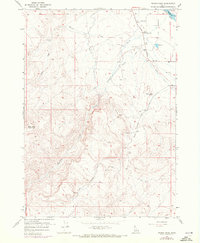
1957 Map of Wilson Peak
USGS Topo · Published 1972About this map
The high desert landscape of Owyhee County, Idaho, is defined here by the sharp contrast between the rugged uplands and the managed water systems of the lower valleys. From the summit of Wilson Peak, the terrain drops toward the Snake River at the northeastern corner, where the Snake River National Wildlife Refuge borders the water's edge. The settlement pattern is sparse, centered primarily around the Wilson Community Hall and the nearby Wilson Cemetery.
Find a feature on this map
22 named features on this map. Tap any name to fly to it.
Don’t see what you’re looking for? This feature index may not catch every label — zoom into the map to look around manually.
Map Details
Editions of this 1957 Wilson Peak Map
2 editions found
Other maps of this area

1892 · Silver City
USGS Topo · 1:125,000

1894 · Silver City
USGS Topo · 1:125,000

1898 · Silver City
USGS Topo · 1:125,000

1955 · Boise
USGS Topo · 1:250,000
1957 · Walters Butte
USGS Topo · 1:24,000

1957 · Opalene Gulch
USGS Topo · 1:24,000

1957 · Wilson Peak
USGS Topo · 1:24,000

1957 · Sands Basin
USGS Topo · 1:62,500

1958 · Boise
USGS Topo · 1:250,000
1958 · Givens Hot Springs
USGS Topo · 1:24,000