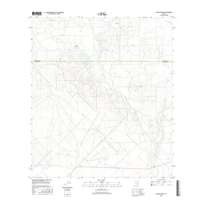
2016 Map of Wilson Ranch
USGS Topo · Published 2016About this map
The Wilson Ranch sits at the northern end of this South Texas landscape, where the rolling ranchlands of the Medina and Frio county line are defined by an intricate network of intermittent creek beds. Water management in this semi-arid region is evident through features like Wilson Lake and Eschenburg Lake, which catch runoff from the surrounding drainages. The terrain is characterized by the branching paths of Seco Cr and Live Oak Cr, which cut through the brush country toward the south. A sparse network of county roads, including Co RD 731 and Co RD 733, provides access to these remote ranching outposts. This 2016 survey documents the modern drainage patterns and land divisions of the Texas Hill Country fringe before further rural development or environmental changes shift the local hydrology.
Find a feature on this map
16 named features on this map. Tap any name to fly to it.
Don’t see what you’re looking for? This feature index may not catch every label — zoom into the map to look around manually.
Map Details
Editions of this 2016 Wilson Ranch Map
This is the sole edition of this map. No revisions or reprints were ever made.
Other maps of this area

1925 · Pearsall 1-b
USGS Topo · 1:48,000

1927 · Pearsall
USGS Topo · 1:62,500

1928 · Frio Town
USGS Topo · 1:62,500

1942 · Divot
USGS Topo · 1:62,500

1953 · Crystal City
USGS Topo · 1:250,000

1954 · San Antonio
USGS Topo · 1:250,000

1955 · Crystal City
USGS Topo · 1:250,000

1956 · Divot
USGS Topo · 1:62,500

1957 · San Antonio
USGS Topo · 1:250,000

1961 · Crystal City
USGS Topo · 1:250,000