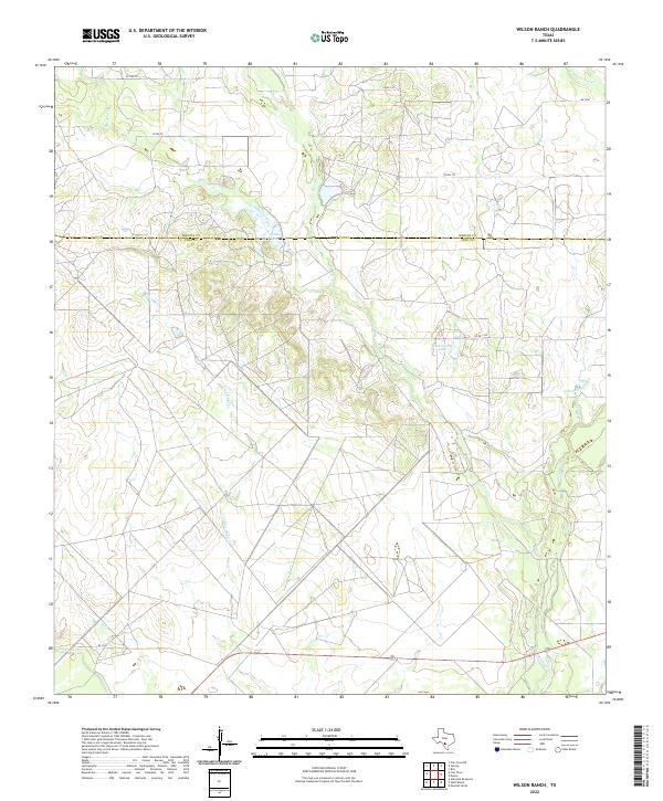
2022 Map of Wilson Ranch
USGS Topo · Published 2022About this map
Squirrel Creek and Seco Creek carve through this landscape at the border of Medina and Frio counties. The terrain is characterized by a network of ranch roads and intermittent drainages, including the prominent Wilson Lake and Eschenburg Lake. These water sources were critical for the development of the region's livestock industry, providing essential catchment in a semiarid environment. While much of the area remains rural and sparsely populated, the map reveals the layout of private and county roads such as County Road 731 and FM 2200, which facilitate movement between these extensive land holdings. In the southeastern corner, the course of Hondo Creek and Tehuacana Creek provide further geographical context for the local drainage patterns that have shaped land use since the early settlement of south-central Texas.
Find a feature on this map
19 named features on this map. Tap any name to fly to it.
Don’t see what you’re looking for? This feature index may not catch every label — zoom into the map to look around manually.
Map Details
Editions of this 2022 Wilson Ranch Map
This is the sole edition of this map. No revisions or reprints were ever made.
Other maps of this area

1925 · Pearsall 1-b
USGS Topo · 1:48,000

1927 · Pearsall
USGS Topo · 1:62,500

1928 · Frio Town
USGS Topo · 1:62,500

1942 · Divot
USGS Topo · 1:62,500

1953 · Crystal City
USGS Topo · 1:250,000

1954 · San Antonio
USGS Topo · 1:250,000

1955 · Crystal City
USGS Topo · 1:250,000

1956 · Divot
USGS Topo · 1:62,500

1957 · San Antonio
USGS Topo · 1:250,000

1961 · Crystal City
USGS Topo · 1:250,000