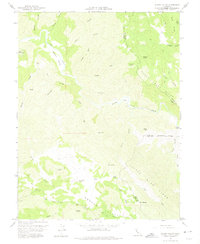
1958 Map of Wilson Valley
USGS Topo · Published 1975About this map
Cache Creek winds through a complex network of canyons and ridges in this late-1950s survey of the Lake County interior. The map illustrates a landscape primarily defined by water and elevation, where Wilson Valley and Kennedy Flats provide rare level ground amidst the prominent peaks of Round Mtn and Grizzly Peak. To the south, Morgan Valley Road serves as the primary artery through Morgan Valley, passing by named landmarks like Butte Rock and Twin Sisters.
Find a feature on this map
46 named features on this map. Tap any name to fly to it.
Don’t see what you’re looking for? This feature index may not catch every label — zoom into the map to look around manually.
Map Details
Editions of this 1958 Wilson Valley Map
3 editions found
Other maps of this area

1920 · Venado
USGS Topo · 1:62,500

1924 · Bartlett Springs
USGS Topo · 1:62,500

1942 · Bartlett Springs
USGS Topo · 1:62,500

1943 · Morgan Valley
USGS Topo · 1:62,500

1944 · Bartlett Springs
USGS Topo · 1:62,500

1944 · Wilbur Springs
USGS Topo · 1:62,500

1944 · Morgan Valley
USGS Topo · 1:62,500

1945 · Lower Lake
USGS Topo · 1:62,500

1947 · Santa Rosa
USGS Topo · 1:250,000

1949 · Santa Rosa
USGS Topo · 1:250,000