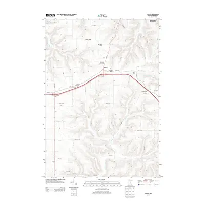
2013 Map of Wilson
USGS Topo · Published 2013About this map
The settlement of Wilson serves as the focal point of this rural Winona County landscape, situated where the ridge tops meet the descending coulees of southeastern Minnesota. The topography is defined by a series of prominent valleys, including Gilmore Valley, West Burns Valley, and Wiscoy Valley, which reveal the deeply dissected nature of the Driftless Area. For genealogists and local historians, the map is particularly rich in cemetery locations, documenting local burial sites like Immaculate Conception Cem, Trinity Cem, and Frank Hill Cem. These landmarks, along with the scattered township boundaries such as Hart Twp 12 and Wiscoy Twp 10, trace the historical organization of the farming community. The presence of L and D Dairy and various creek systems, such as Money Cr and Pleasant Valley Cr, reflects the enduring agricultural and hydraulic character of the region south of Winona.
Find a feature on this map
47 named features on this map. Tap any name to fly to it.
Don’t see what you’re looking for? This feature index may not catch every label — zoom into the map to look around manually.
Map Details
Editions of this 2013 Wilson Map
This is the sole edition of this map. No revisions or reprints were ever made.
Other maps of this area

1929 · Fountain City
USGS Topo · 1:62,500

1932 · Cochrane
USGS Topo · 1:62,500

1934 · Winona
USGS Topo · 1:62,500

1934 · Cochrane
USGS Topo · 1:62,500

1937 · Winona
USGS Topo · 1:62,500

1937 · Cochrane
USGS Topo · 1:62,500

1953 · Eau Claire
USGS Topo · 1:250,000

1954 · Lewiston
USGS Topo · 1:62,500

1958 · Eau Claire
USGS Topo · 1:250,000

1958 · Houston
USGS Topo · 1:62,500