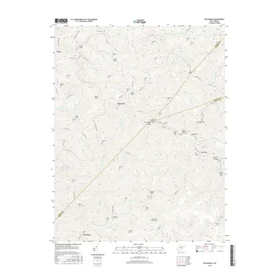
2016 Map of Wilsondale
USGS Topo · Published 2016About this map
Martinsridge and Beech Ridge define the steep, creek-cut landscape of this region where Wayne, Mingo, and Lincoln counties meet. The settlement of Wilsondale sits at the heart of a network of hollows and ridges, including Perry Ridge and Tick Ridge. This 2016 survey documents a dense cluster of family burial grounds and small community landmarks that speak to the deep genealogical roots of the area. Notable sites include the Lord Fleming Memorial Bridge and the Breeden Tunnel, alongside numerous remote cemeteries such as Stroud Cem, Baisden Cem, and the Matty Ferguson Cem. The drainage patterns of Turkey Cr, Jennie Cr, and Spruce Fork dictate the location of local roads like Turkey Creek Rd, which follow the narrow valley floors between heights like Kelly Knob and Antley Knob.
Find a feature on this map
126 named features on this map. Tap any name to fly to it.
Don’t see what you’re looking for? This feature index may not catch every label — zoom into the map to look around manually.
Map Details
Editions of this 2016 Wilsondale Map
This is the sole edition of this map. No revisions or reprints were ever made.
Other maps of this area

1887 · Warfield
USGS Topo · 1:125,000

1891 · Warfield
USGS Topo · 1:125,000

1892 · Huntington
USGS Topo · 1:125,000

1898 · Huntington
USGS Topo · 1:125,000

1902 · Midkiff
USGS Topo · 1:62,500

1907 · Midkiff
USGS Topo · 1:62,500

1909 · Wayne
USGS Topo · 1:62,500

1909 · Midkiff
USGS Topo · 1:62,500

1910 · Holden
USGS Topo · 1:48,000

1910 · Naugatuck
USGS Topo · 1:48,000