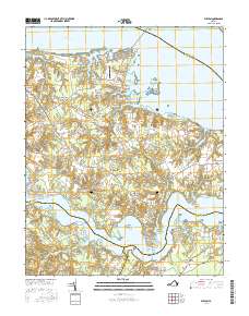
2016 Map of Wilton
USGS Topo · Published 2016About this map
The Tidewater region of Virginia, where the Rappahannock River and Piankatank River define a landscape of deeply finger-cut peninsulas, is documented here in 2016. The map reveals the intricate shoreline of Middlesex County, where points like Ginney Point, Doctor Point, and Greys Point extend into the broad tidal waters. Inland, small crossroad communities such as Free Shade Corner, Hartfield, and Syringa anchor the rural infrastructure between the marshes and creeks.
Find a feature on this map
64 named features on this map. Tap any name to fly to it.
Don’t see what you’re looking for? This feature index may not catch every label — zoom into the map to look around manually.
Map Details
Editions of this 2016 Wilton Map
This is the sole edition of this map. No revisions or reprints were ever made.
Other maps of this area

1906 · Williamsburg
USGS Topo · 1:62,500

1916 · Kilmarnock
USGS Topo · 1:48,000

1916 · Mathews
USGS Topo · 1:62,500

1917 · Urbanna
USGS Topo · 1:62,500

1917 · Kilmarnock
USGS Topo · 1:62,500

1917 · Mathews
USGS Topo · 1:62,500

1942 · Kilmarnock
USGS Topo · 1:62,500

1943 · Richmond
USGS Topo · 1:250,000
1946 · Urbanna
USGS Topo · 1:24,000

1948 · Ware Neck
USGS Topo · 1:24,000