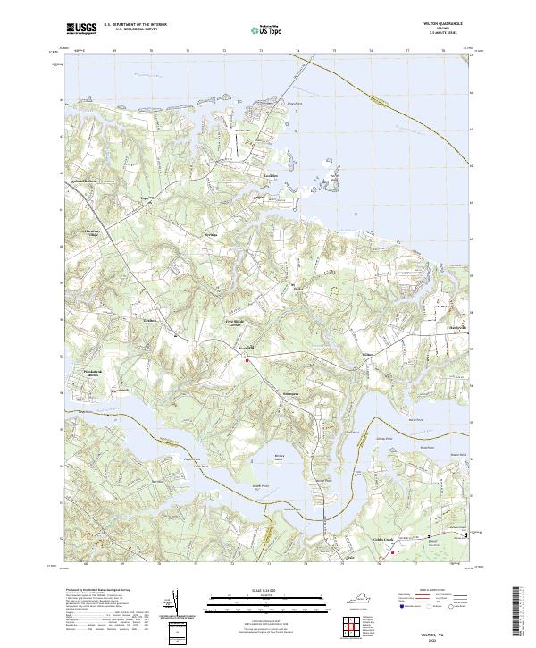
2022 Map of Wilton
USGS Topo · Published 2022About this map
Piankatank River and the Rappahannock River define this coastal Virginia landscape, where the peninsula is deeply incised by tidal creeks and marshlands. The mapping detail highlights a transition from traditional riverside landings to modern aviation at Hummel Field. Local genealogy is well-served by the inclusion of several burial sites, including Ebenezer Baptist Church Cem, Haynes Cem, and Mathews Chapel Cem, situated near established settlements like Cobbs Creek and Dixie.
Find a feature on this map
185 named features on this map. Tap any name to fly to it.
Don’t see what you’re looking for? This feature index may not catch every label — zoom into the map to look around manually.
Map Details
Editions of this 2022 Wilton Map
This is the sole edition of this map. No revisions or reprints were ever made.
Other maps of this area

1906 · Williamsburg
USGS Topo · 1:62,500

1916 · Kilmarnock
USGS Topo · 1:48,000

1916 · Mathews
USGS Topo · 1:62,500

1917 · Urbanna
USGS Topo · 1:62,500

1917 · Kilmarnock
USGS Topo · 1:62,500

1917 · Mathews
USGS Topo · 1:62,500

1942 · Kilmarnock
USGS Topo · 1:62,500

1943 · Richmond
USGS Topo · 1:250,000
1946 · Urbanna
USGS Topo · 1:24,000

1948 · Ware Neck
USGS Topo · 1:24,000