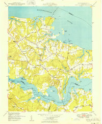
1949 Map of Wilton
USGS Topo · Published 1949About this map
Rappahannock River and Piankatank River define the peninsular character of this coastal landscape, where the local economy in the late 1940s remained deeply tied to the water. The intricate shoreline of Middlesex County is dotted with specialized infrastructure like Blands Wharf, Stampers Wharf, and New Mill Creek Wharf, indicating the continued importance of maritime transport for agriculture and industry. Inland, the map reveals a network of small communities such as Harmony Village, Syringa, and Hartfield, connected by roads like Grey Point Road and Delta Ville Road.
Find a feature on this map
76 named features on this map. Tap any name to fly to it.
Don’t see what you’re looking for? This feature index may not catch every label — zoom into the map to look around manually.
Map Details
Editions of this 1949 Wilton Map
This is the sole edition of this map. No revisions or reprints were ever made.
Other maps of this area

1906 · Williamsburg
USGS Topo · 1:62,500

1916 · Kilmarnock
USGS Topo · 1:48,000

1916 · Mathews
USGS Topo · 1:62,500

1917 · Urbanna
USGS Topo · 1:62,500

1917 · Kilmarnock
USGS Topo · 1:62,500

1917 · Mathews
USGS Topo · 1:62,500

1942 · Kilmarnock
USGS Topo · 1:62,500

1943 · Richmond
USGS Topo · 1:250,000
1946 · Urbanna
USGS Topo · 1:24,000

1948 · Ware Neck
USGS Topo · 1:24,000