1956 Map of Wimauma
USGS Topo · Published 1970About this map
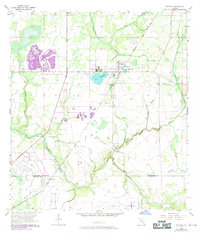
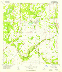
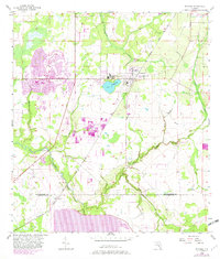
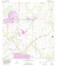
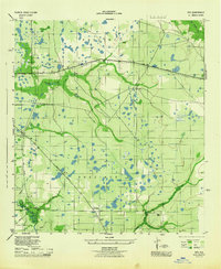
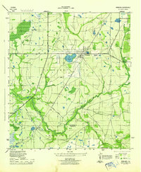
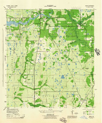
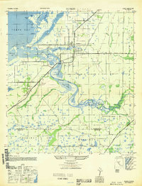
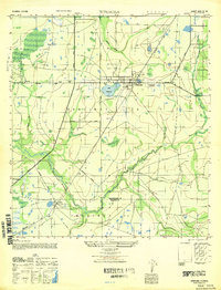
Wimauma sits as the central settlement on this 1956 survey, which was later updated in 1970 to show expanding residential patterns near Lake Wimauma and Moody Pond. The landscape is defined by the hydrologic network of south-central Florida, notably the winding course of the Little Manatee River and its various tributaries like Dug Creek, Gully Branch, and the South Fork. The Seaboard Coast Line railroad cuts a diagonal path through the terrain, connecting the town of Wimauma with the southern community of Willow near the boundary of Hillsborough and Manatee Counties. Industrial activity is marked by a Sandpit and a Gaging Station along the riverbanks. This edition provides a distinct look at the area's transition, with purple overlays indicating urban growth that occurred between the original mid-century survey and the 1970 publication date.
Find a feature on this map
15 named features on this map. Tap any name to fly to it.
Don’t see what you’re looking for? This feature index may not catch every label — zoom into the map to look around manually.
Map Details
Editions of this 1956 Wimauma Map
4 editions found
Other maps of this area

1921 · Tampa
USGS Topo · 1:62,500

1944 · Ruskin
USGS Topo · 1:31,680
1944 · Rye
USGS Topo · 1:31,680
1944 · Wimauma
USGS Topo · 1:31,680

1944 · Parish
USGS Topo · 1:31,680
1944 · Balm
USGS Topo · 1:31,680

1945 · Gadsden Point
USGS Topo · 1:31,680
1947 · Ruskin
USGS Topo · 1:25,000
1947 · Wimauma
USGS Topo · 1:25,000

1947 · Gadsden Point
USGS Topo · 1:25,000