1956 Map of Wimauma
USGS Topo · Published 1987About this map
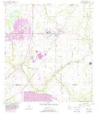
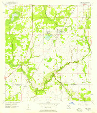
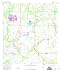
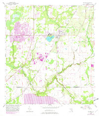
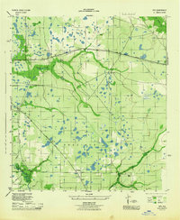
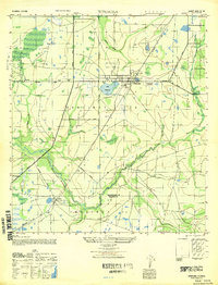
Sun City Center emerges as a prominent planned community in this mid-century landscape, positioned north of the winding Little Manatee River. The map illustrates a period of significant growth, with purple-shaded areas indicating urban expansion around the established core of Wimauma and the Lake Wimauma waterfront. The terrain is defined by a dense network of drainage systems, including Bullfrog Creek and Cypress Creek, which feed into the primary river valley. To the south, the boundary between Hillsborough and Manatee counties crosses near the small settlement of Willow, where the CSX railroad line runs. The presence of the Sun City Center Airpark and a Gaging Station on the river highlights the mix of modern infrastructure and hydrological management characterizing this part of Florida during its post-war developmental shift.
Find a feature on this map
16 named features on this map. Tap any name to fly to it.
Don’t see what you’re looking for? This feature index may not catch every label — zoom into the map to look around manually.
Map Details
Editions of this 1956 Wimauma Map
4 editions found
Other maps of this area

1921 · Tampa
USGS Topo · 1:62,500

1944 · Ruskin
USGS Topo · 1:31,680
1944 · Rye
USGS Topo · 1:31,680
1944 · Wimauma
USGS Topo · 1:31,680

1944 · Parish
USGS Topo · 1:31,680
1944 · Balm
USGS Topo · 1:31,680

1945 · Gadsden Point
USGS Topo · 1:31,680
1947 · Ruskin
USGS Topo · 1:25,000
1947 · Wimauma
USGS Topo · 1:25,000

1947 · Gadsden Point
USGS Topo · 1:25,000