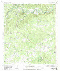
1989 Map of Wimberley
USGS Topo · Published 1989About this map
The Blanco River snakes through the heart of this Texas Hill Country landscape, serving as the primary geographical anchor for the community of Wimberley. This 1989 revision, produced in cooperation with the Texas Water Development Board, illustrates the town's position at the confluence of the river and Cypress Creek, where a Gaging Sta monitors the seasonal flow. The map reveals a transition from the established town center to outlying residential areas like Flite Acres, connected by winding routes such as Flite Acres Road.
Find a feature on this map
24 named features on this map. Tap any name to fly to it.
Don’t see what you’re looking for? This feature index may not catch every label — zoom into the map to look around manually.
Map Details
Editions of this 1989 Wimberley Map
This is the sole edition of this map. No revisions or reprints were ever made.
Other maps of this area

1887 · Blanco
USGS Topo · 1:125,000

1894 · Blanco
USGS Topo · 1:125,000

1896 · Austin
USGS Topo · 1:125,000

1897 · Austin
USGS Topo · 1:125,000

1910 · Austin
USGS Topo · 1:125,000

1911 · San Marcos
USGS Topo · 1:125,000

1919 · San Marcos
USGS Topo · 1:125,000

1925 · Hunter No 3
USGS Topo · 1:48,000

1929 · Hunter
USGS Topo · 1:62,500

1953 · Seguin
USGS Topo · 1:250,000