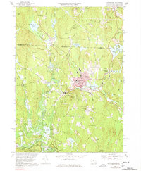
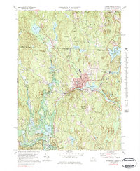
1971 Map of Winchendon
USGS Topo · Published 1978About this map
The industrial and civic heart of north-central Massachusetts is centered on the confluence of the Millers River and various brooks in the early 1970s. This survey shows the dense street grid of Winchendon during a period of established manufacturing and rail service, with the Boston And Maine Railroad cutting through the town and passing the Whites Mill pond. The map reveals a distinct hierarchy of settlement, from the central hub to outlying villages like Harrisville, Bullardville, and Winchendon Springs.
Find a feature on this map
108 named features on this map. Tap any name to fly to it.
Don’t see what you’re looking for? This feature index may not catch every label — zoom into the map to look around manually.
Map Details
Editions of this 1971 Winchendon Map
5 editions found
Other maps of this area

1887 · Winchendon
USGS Topo · 1:62,500

1887 · Fitchburg
USGS Topo · 1:62,500

1889 · Fitchburg
USGS Topo · 1:62,500

1890 · Winchendon
USGS Topo · 1:62,500

1893 · Fitchburg
USGS Topo · 1:62,500

1894 · Winchendon
USGS Topo · 1:62,500

1898 · Monadnock
USGS Topo · 1:62,500

1900 · Peterboro
USGS Topo · 1:62,500

1931 · Fitchburg
USGS Topo · 1:48,000

1932 · Winchendon
USGS Topo · 1:48,000