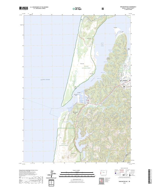
2024 Map of Winchester Bay
USGS Topo · Published 2024About this map
The Umpqua River defines the landscape as it reaches the Pacific, creating a complex network of coves and islands near Winchester Bay and Reedsport. This modern survey illustrates the coastal geography of the North Spit and the intricate shoreline of the Henderson Cove and Jerden Cove areas. The map details the interface between the Siuslaw National Forest and the protected Oregon Islands Wilderness, providing a clear view of the local topography from Drake Dune to Brushy Hill. Genealogists and local historians can locate the Masonic Cem near Wades Flat, while the alignment of the Oregon Coast Highway and Salmon Harbor Dr shows the primary transit corridors for the region's coastal economy. Residential and commercial development is concentrated around the established waterfronts, framed by the river's path around Leeds Island.
Find a feature on this map
52 named features on this map. Tap any name to fly to it.
Don’t see what you’re looking for? This feature index may not catch every label — zoom into the map to look around manually.
Map Details
Editions of this 2024 Winchester Bay Map
This is the sole edition of this map. No revisions or reprints were ever made.
Other maps of this area

1920 · Siltcoos Lake
USGS Topo · 1:62,500

1923 · Reedsport
USGS Topo · 1:62,500

1941 · Siltcoos Lake
USGS Topo · 1:62,500

1942 · Siltcoos Lake
USGS Topo · 1:62,500

1942 · Reedsport
USGS Topo · 1:62,500

1954 · Coos Bay
USGS Topo · 1:250,000
1956 · Reedsport
USGS Topo · 1:62,500
1956 · Siltcoos Lake
USGS Topo · 1:62,500

1958 · Coos Bay
USGS Topo · 1:250,000

1962 · Coos Bay
USGS Topo · 1:250,000