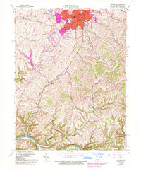
1965 Map of Winchester
USGS Topo · Published 1993About this map
Winchester serves as the focal point of this mid-century landscape, showing the city's expansion through residential additions like Wesleyan Park, Colby Hills, and Hampton Manor. The map captures a transition from the urban density of the Courthouse and Clark Co Hospital to the outlying agrarian terrain and steep hillsides near the Kentucky River. Educational and religious foundations are prominent, ranging from Southeastern Christian College in the heart of town to the rural Antioch Ch and Providence Sch to the southwest.
Find a feature on this map
57 named features on this map. Tap any name to fly to it.
Don’t see what you’re looking for? This feature index may not catch every label — zoom into the map to look around manually.
Map Details
Editions of this 1965 Winchester Map
3 editions found
Other maps of this area

1892 · Richmond
USGS Topo · 1:125,000

1897 · Richmond
USGS Topo · 1:125,000

1927 · Lexington
USGS Topo · 1:48,000

1929 · Lexington
USGS Topo · 1:62,500

1952 · Union City
USGS Topo · 1:24,000

1952 · Palmer
USGS Topo · 1:24,000

1952 · Clintonville
USGS Topo · 1:24,000

1952 · Austerlitz
USGS Topo · 1:24,000

1952 · Ford
USGS Topo · 1:24,000

1952 · Winchester
USGS Topo · 1:24,000