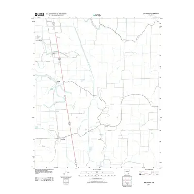
2011 Map of Winchester
USGS Topo · Published 2011About this map
Winchester and the surrounding agricultural landscapes of Desha County are defined by a network of drainage canals and historical family plots. The settlement of Pickens sits at the northern edge, supported by the Pickens Airport and the Dumas Billy Free Municipal aviation facilities. This 2011 survey reveals a landscape deeply tied to its water management history, featuring Canal Number 19 and several bayous including Amos Bayou, Dry Bayou, and Coon Bayou. Genealogists will find a high concentration of burial sites throughout the quadrangle, from Walnut Lake Cemetery near the Walnut Lake Dam to more isolated sites like Dixon Cemetery, Newton Cemetery, Jefferson Cemetery, Scott Cemetery, and Hopkins Cemetery. Smaller residential pockets at Omega and Yukon are connected by a grid of county roads, reflecting the persistent rural settlement patterns of the Arkansas Delta in the early 21st century.
Find a feature on this map
53 named features on this map. Tap any name to fly to it.
Don’t see what you’re looking for? This feature index may not catch every label — zoom into the map to look around manually.
Map Details
Editions of this 2011 Winchester Map
This is the sole edition of this map. No revisions or reprints were ever made.
Other maps of this area

1935 · Cominto
USGS Topo · 1:62,500

1935 · Rotan
USGS Topo · 1:62,500

1935 · Red Fork
USGS Topo · 1:62,500

1936 · McGehee
USGS Topo · 1:62,500

1937 · McGehee
USGS Topo · 1:62,500

1953 · Greenwood
USGS Topo · 1:250,000

1955 · McGehee
USGS Topo · 1:62,500

1956 · Greenwood
USGS Topo · 1:250,000

1960 · Selma
USGS Topo · 1:24,000

1960 · Collins
USGS Topo · 1:62,500