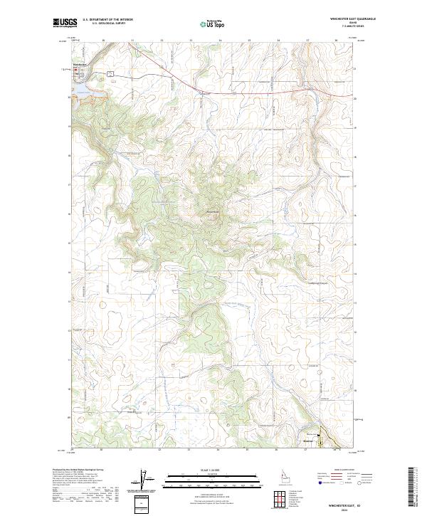
2024 Map of Winchester East
USGS Topo · Published 2024About this map
Winchester sits at the edge of the plateau where the Nez Perce reservation highlands begin their descent toward the Clearwater River basin. The landscape is defined by the high-elevation Lapwai Lake and a complex drainage system including Lapwai Creek and the North Fork Willow Creek. Rural development is concentrated along a network of named county roads like Talmaks Rd and Woodside Rd, which connect the high prairie farmland to the smaller settlement of Morrow.
Find a feature on this map
47 named features on this map. Tap any name to fly to it.
Don’t see what you’re looking for? This feature index may not catch every label — zoom into the map to look around manually.
Map Details
Editions of this 2024 Winchester East Map
This is the sole edition of this map. No revisions or reprints were ever made.
Other maps of this area

1924 · Kamiah
USGS Topo · 1:125,000

1955 · Pullman
USGS Topo · 1:250,000

1958 · Pullman
USGS Topo · 1:250,000

1958 · Culdesac
USGS Topo · 1:62,500

1967 · Fletcher
USGS Topo · 1:24,000

1967 · Craigmont
USGS Topo · 1:24,000

1967 · Hoover Point
USGS Topo · 1:24,000

1967 · Westlake
USGS Topo · 1:24,000
1967 · Keuterville
USGS Topo · 1:24,000
1967 · Winchester East
USGS Topo · 1:24,000