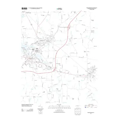
2013 Map of Winchester
USGS Topo · Published 2013About this map
Winchester serves as a central hub in this Southern Tennessee landscape, where the urban street grid meets the sprawling waters of Tims Ford Lake and its numerous branches like Hessey Br. The map highlights a corridor of development connecting Decherd and Cowan, traced by the CSX Transportation railroad line that skirts the base of the Cumberland Plateau foothills. Local aviation is well-represented by the Winchester Municipal Airport and the smaller King Airport to the south. Residential growth is evident in named neighborhoods like Bel-Aire Heights and Mountain View Acres, while the outlying areas maintain a traditional rural character with landmarks such as Keith Cove and Penile Hill. The drainage patterns of Boiling Fork Cr and Norwood Cr illustrate the complex hydrology of the region as it transitions from valley floor to rising elevations.
Find a feature on this map
256 named features on this map. Tap any name to fly to it.
Don’t see what you’re looking for? This feature index may not catch every label — zoom into the map to look around manually.
Map Details
Editions of this 2013 Winchester Map
This is the sole edition of this map. No revisions or reprints were ever made.
Other maps of this area

1895 · Sewanee
USGS Topo · 1:125,000

1928 · Decherd
USGS Topo · 1:62,500

1936 · Sewanee
USGS Topo · 1:24,000

1936 · Alto
USGS Topo · 1:24,000

1936 · Sinking Cove
USGS Topo · 1:24,000

1936 · Beans Creek
USGS Topo · 1:24,000

1936 · Winchester
USGS Topo · 1:24,000

1936 · Belvidere
USGS Topo · 1:24,000

1936 · Pitcher Ridge
USGS Topo · 1:24,000

1936 · Camp Peay
USGS Topo · 1:24,000