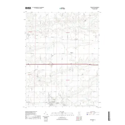
2018 Map of Winchester
USGS Topo · Published 2018About this map
Winchester serves as the focal point of this Scott County landscape, where the confluence of several rural roads and the Winchester Post Office anchor the local community. The terrain is defined by a dense network of drainage systems, including Mauvaise Terre Creek and Big Sandy Cr, which have carved intricate patterns into the agricultural land. Family and community history is exceptionally well-preserved through a high concentration of small, named burial grounds. Genealogists will find a wealth of specific sites such as Borum Cem, Berry Farm Cem, Young E S Mac Cem, and the Saint Mark's Catholic Cem. These small cemeteries, scattered from the northern reaches near Exeter down to the southern township lines, reflect the deep-rooted family farming heritage of this part of Illinois. Smaller settlements like Merritt and Riggston remain as quiet nodes in a landscape also featuring Freesen Lake and the winding course of Walnut Cr.
Find a feature on this map
83 named features on this map. Tap any name to fly to it.
Don’t see what you’re looking for? This feature index may not catch every label — zoom into the map to look around manually.
Map Details
Editions of this 2018 Winchester Map
This is the sole edition of this map. No revisions or reprints were ever made.
Other maps of this area

1924 · Winchester
USGS Topo · 1:48,000

1924 · Griggsville
USGS Topo · 1:62,500

1926 · Griggsville
USGS Topo · 1:62,500

1926 · Winchester
USGS Topo · 1:62,500

1928 · Meredosia
USGS Topo · 1:62,500

1929 · Arenzville
USGS Topo · 1:62,500

1931 · Meredosia
USGS Topo · 1:62,500

1932 · Arenzville
USGS Topo · 1:62,500

1948 · Quincy
USGS Topo · 1:250,000

1956 · Quincy
USGS Topo · 1:250,000