Loading...
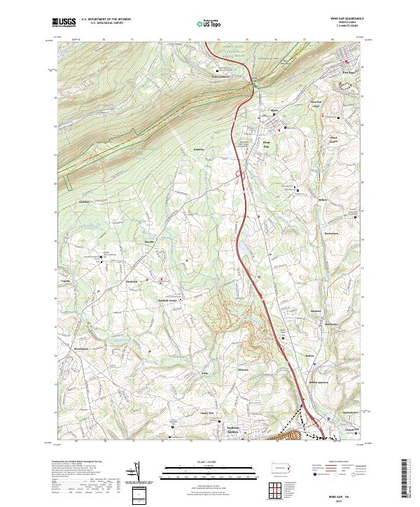
Loading map...2023 Map of Wind Gap
USGS Topo · Published 2023About this map
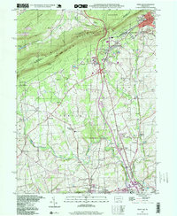
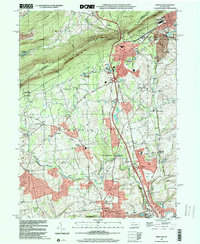
Blue Mountain and Kittatinny Mtn form the defining geological spine of this region, carved by the pass at Wind Gap. This 2023 edition documents a landscape where residential expansion meets protected lands, including the Cherry Valley National Wildlife Refuge and the Appalachian National Scenic Trail. The map details a dense network of smaller settlements such as Aluta, Belfast, and Bushkill Center, many centered on historic intersections and proximity to Bushkill Creek.
Find a feature on this map
65 named features on this map. Tap any name to fly to it.
Don’t see what you’re looking for? This feature index may not catch every label — zoom into the map to look around manually.
Map Details
Date Portrayed2023
Date Published2023
PublisherU.S. Geological Survey
Map TypeTopographic
Scale1:24000
Physical Dimensions24 x 29 inches
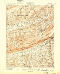
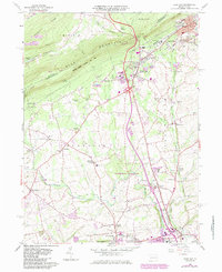
Editions of this 2023 Wind Gap Map
This is the sole edition of this map. No revisions or reprints were ever made.
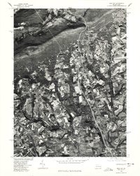
Historical Maps of Alpha Through Time
8 maps found


Featured Locations
- Bushkill Township, PA
- Pen Argyl, PA
- Wind Gap, PA
- Clearfield, Bushkill Township
- Sours Mills, Bushkill Township
Source Details
SourceU.S. Geological Survey
CopyrightPublic Domain