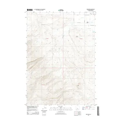
2015 Map of Wind River
USGS Topo · Published 2015About this map
The Wind River landscape in Fremont County is defined by a complex network of high-elevation drainages and local landmarks. To the east, the terrain levels toward Alkali Lake and the marshy Dead Horse Slough, while the western and southern reaches rise sharply toward Cedar Butte. Notable local infrastructure includes the Old Wind River Hwy and a series of rural access points such as Cemetery Ln and Sundance Grounds Rd. The mapping reveals a distinct water system where Crooked Cr and Trout Cr carve through the northern sections. This 2015 survey provides a clear view of the rural township boundaries, specifically t1s r1w and t2s r2w, documenting the modern intersection of traditional names and established land use in this part of Wyoming.
Find a feature on this map
25 named features on this map. Tap any name to fly to it.
Don’t see what you’re looking for? This feature index may not catch every label — zoom into the map to look around manually.
Map Details
Editions of this 2015 Wind River Map
This is the sole edition of this map. No revisions or reprints were ever made.
Other maps of this area

1937 · Moccasin Lake
USGS Topo · 1:48,000

1943 · Moccasin Lake
USGS Topo · 1:62,500

1951 · Fort Washakie
USGS Topo · 1:24,000

1951 · Ethete
USGS Topo · 1:24,000

1952 · Wise Flat
USGS Topo · 1:24,000

1952 · Ray Lake
USGS Topo · 1:24,000

1952 · Wind River
USGS Topo · 1:24,000

1953 · Mount Arter
USGS Topo · 1:24,000

1953 · Mount Arter SE
USGS Topo · 1:24,000

1955 · Thermopolis
USGS Topo · 1:250,000