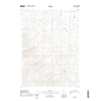
2017 Map of Wind River
USGS Topo · Published 2017About this map
Sacajawea Cem stands as a focal point for local history on this landscape, situated near Cemetery Ln and the Sundance Grounds Rd. The terrain is defined by the winding course of the Wind River, which is fed by numerous tributaries including Trout Cr, Crooked Cr, and Spring Cr. This network of waterways, combined with landmarks like Dead Horse Slough and Alkali Lake, illustrates a complex riparian environment managed through a grid of rural routes such as the Old Wind River Hwy and S Fork Rd. Further south, the topography shifts towards notable high points like Cedar Butte and drainage systems including Mill Cr and Surrell Cr. The placement of these features relative to historical land divisions like t1s r2w and t2s r1w provides essential context for understanding early twentieth-century land use and settlement patterns in this part of Fremont County.
Find a feature on this map
25 named features on this map. Tap any name to fly to it.
Don’t see what you’re looking for? This feature index may not catch every label — zoom into the map to look around manually.
Map Details
Editions of this 2017 Wind River Map
This is the sole edition of this map. No revisions or reprints were ever made.
Other maps of this area

1937 · Moccasin Lake
USGS Topo · 1:48,000

1943 · Moccasin Lake
USGS Topo · 1:62,500

1951 · Fort Washakie
USGS Topo · 1:24,000

1951 · Ethete
USGS Topo · 1:24,000

1952 · Wise Flat
USGS Topo · 1:24,000

1952 · Ray Lake
USGS Topo · 1:24,000

1952 · Wind River
USGS Topo · 1:24,000

1953 · Mount Arter
USGS Topo · 1:24,000

1953 · Mount Arter SE
USGS Topo · 1:24,000

1955 · Thermopolis
USGS Topo · 1:250,000