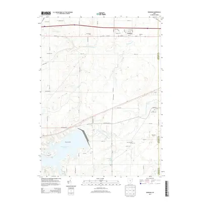
2013 Map of Windham
USGS Topo · Published 2013About this map
The Michael J Kirwan Reservoir dominates the southwestern quadrant of this landscape, its waters surrounding Hickory Island and defining the local drainage patterns. North of the reservoir, the village of Windham serves as a central hub, flanked by agricultural holdings like Rocky Meadow Farms and Four Leaf Farm. The map provides a detailed view of the borderlands between Portage Co and Trumbull Co, where the West Branch Mahoning River snakes through the lowlands toward the southeast corner. Genealogists will find interest in several local burying grounds, including Saint Josephs Cem, Hawley Cem, and Welsh Cem. The area’s small-scale aviation history is noted by the presence of Bossow Airport and Dunn Field Airport, while the eastern terrain is marked by smaller water bodies like Marys Lake and the winding course of Kale Cr.
Find a feature on this map
64 named features on this map. Tap any name to fly to it.
Don’t see what you’re looking for? This feature index may not catch every label — zoom into the map to look around manually.
Map Details
Editions of this 2013 Windham Map
This is the sole edition of this map. No revisions or reprints were ever made.
Other maps of this area

1905 · Bristolville
USGS Topo · 1:62,500

1905 · Garrettsville
USGS Topo · 1:62,500

1906 · Ravenna
USGS Topo · 1:62,500

1907 · Bristolville
USGS Topo · 1:62,500

1907 · Garrettsville
USGS Topo · 1:62,500

1908 · Warren
USGS Topo · 1:62,500

1908 · Ravenna
USGS Topo · 1:62,500

1950 · Cleveland
USGS Topo · 1:250,000

1952 · Lake Milton
USGS Topo · 1:24,000

1952 · Southington
USGS Topo · 1:24,000