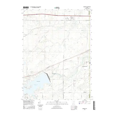
2016 Map of Windham
USGS Topo · Published 2016About this map
The Michael J Kirwan Reservoir dominates the southwestern quadrant of this 2016 survey, a massive water body featuring Hickory Island and Silver Creek Bay. This modern landscape at the Portage, Trumbull, and Mahoning county borders is a mix of small village centers and large-scale infrastructure. The northern section is anchored by the village of Windham, while the southern portion features the hamlets of Wayland and McClintocksburg. A significant portion of the western terrain is occupied by the Ravenna Arsenal, reflecting the area's mid-century military legacy. Local genealogists will find several burial sites noted, including Saint Josephs Cem, Hawley Cem, and Welsh Cem. The West Branch Mahoning River winds through the center of the sheet, feeding the reservoir and defining the local drainage patterns alongside S Fork Eagle Cr and Sand Cr.
Find a feature on this map
61 named features on this map. Tap any name to fly to it.
Don’t see what you’re looking for? This feature index may not catch every label — zoom into the map to look around manually.
Map Details
Editions of this 2016 Windham Map
This is the sole edition of this map. No revisions or reprints were ever made.
Other maps of this area

1905 · Bristolville
USGS Topo · 1:62,500

1905 · Garrettsville
USGS Topo · 1:62,500

1906 · Ravenna
USGS Topo · 1:62,500

1907 · Bristolville
USGS Topo · 1:62,500

1907 · Garrettsville
USGS Topo · 1:62,500

1908 · Warren
USGS Topo · 1:62,500

1908 · Ravenna
USGS Topo · 1:62,500

1950 · Cleveland
USGS Topo · 1:250,000

1952 · Lake Milton
USGS Topo · 1:24,000

1952 · Southington
USGS Topo · 1:24,000