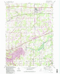
1994 Map of Windham
USGS Topo · Published 1997About this map
The Ravenna Arsenal dominates the central landscape of this eastern Ohio survey, its vast military reservation boundary separating the northern township of Windham from the southern settlements. This area, largely defined by the industrial and defensive needs of the mid-20th century, is also shaped by significant water management projects. The Kirwan Reservoir and its associated Kirwan State Park cover much of the southwestern quadrant, where the Michael Branch feeds into the wider Mahoning River system. Local history is anchored by small rural centers like Wayland, Paris, and Pritchard, alongside several family and community burial grounds including Hawley Cem, Welsh Cem, and St Josephs Cem. The presence of the Conrail line and the Ohio Toll Road Turnpike in the north highlights the region's role as a critical transportation corridor between major industrial hubs.
Find a feature on this map
65 named features on this map. Tap any name to fly to it.
Don’t see what you’re looking for? This feature index may not catch every label — zoom into the map to look around manually.
Map Details
Editions of this 1994 Windham Map
This is the sole edition of this map. No revisions or reprints were ever made.
Other maps of this area

1905 · Bristolville
USGS Topo · 1:62,500

1905 · Garrettsville
USGS Topo · 1:62,500

1906 · Ravenna
USGS Topo · 1:62,500

1907 · Bristolville
USGS Topo · 1:62,500

1907 · Garrettsville
USGS Topo · 1:62,500

1908 · Warren
USGS Topo · 1:62,500

1908 · Ravenna
USGS Topo · 1:62,500

1950 · Cleveland
USGS Topo · 1:250,000

1952 · Lake Milton
USGS Topo · 1:24,000

1952 · Southington
USGS Topo · 1:24,000