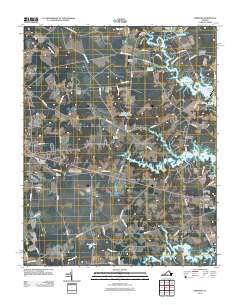
2011 Map of Windsor
USGS Topo · Published 2011About this map
Windsor serves as a central hub on this Atlantic coastal plain landscape, where the town's development radiates along Virginia Ave and Old Suffolk Rd. The region is defined by an intricate network of managed water bodies and historic milling sites, including Murphys Millpond and Branch and Joyner Millpond. These water systems, alongside Lake Prince and Lake Cohoon, illustrate the area's transformation into a significant reservoir and drainage complex for southeastern Virginia.
Find a feature on this map
80 named features on this map. Tap any name to fly to it.
Don’t see what you’re looking for? This feature index may not catch every label — zoom into the map to look around manually.
Map Details
Editions of this 2011 Windsor Map
This is the sole edition of this map. No revisions or reprints were ever made.
Other maps of this area

1919 · Smithfield
USGS Topo · 1:62,500

1919 · Suffolk
USGS Topo · 1:62,500

1920 · Holland
USGS Topo · 1:62,500

1920 · Ivor
USGS Topo · 1:62,500

1943 · Holland
USGS Topo · 1:62,500

1944 · Windsor
USGS Topo · 1:31,680

1944 · Smithfield
USGS Topo · 1:24,000

1944 · Raynor
USGS Topo · 1:24,000

1944 · Zuni
USGS Topo · 1:24,000

1945 · Zuni
USGS Topo · 1:31,680