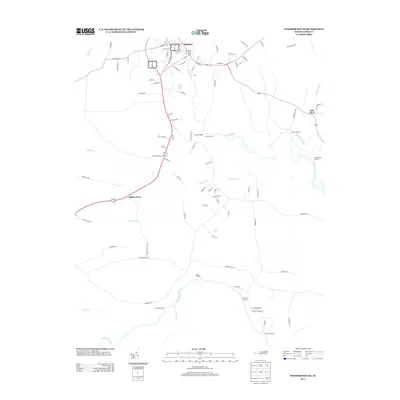
2013 Map of Windsor South
USGS Topo · Published 2013About this map
Windsor serves as the focal point for this survey of the Bertie County lowlands, where the Cashie River meanders toward its confluence with the Roanoke River. The landscape is defined by its relationship to these waterways, evidenced by the numerous landings and quarters that dot the riverbanks. From Robins Landing to Thunderbolt Landing, the map records a tradition of river-access points that once facilitated local commerce and transit. Further inland, the presence of Ellis Store and Millers Store indicates the persistence of rural commercial hubs at key road intersections. The intricate drainage network of Mill Swamp and Roquist Cr reveals a terrain historically shaped by water, where development is concentrated along the ridges and higher ground north of the expansive Conine Cr wetlands.
Find a feature on this map
85 named features on this map. Tap any name to fly to it.
Don’t see what you’re looking for? This feature index may not catch every label — zoom into the map to look around manually.
Map Details
Editions of this 2013 Windsor South Map
This is the sole edition of this map. No revisions or reprints were ever made.
Other maps of this area

1901 · Williamston
USGS Topo · 1:62,500

1902 · Williamston
USGS Topo · 1:62,500

1943 · Plymouth
USGS Topo · 1:125,000

1953 · Norfolk
USGS Topo · 1:250,000

1953 · Rocky Mount
USGS Topo · 1:250,000

1954 · Rocky Mount
USGS Topo · 1:250,000

1972 · Republican
USGS Topo · 1:24,000
1978 · Jamesville
USGS Topo · 1:24,000

1978 · Windsor South
USGS Topo · 1:24,000
1979 · Plymouth West
USGS Topo · 1:24,000