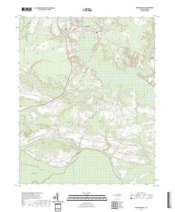
2022 Map of Windsor South
USGS Topo · Published 2022About this map
The Bertie County Courthouse stands as a central landmark in Windsor, situated at the northern edge of this coastal plain landscape. The terrain is defined by a dense network of watercourses, where the Cashie River and Roquist Cr flow through expansive wetlands before reaching the southern boundary formed by the Roanoke River. This riverine environment is characterized by large landforms such as Conine Island, which is separated from the mainland by the winding path of Conine Cr.
Find a feature on this map
51 named features on this map. Tap any name to fly to it.
Don’t see what you’re looking for? This feature index may not catch every label — zoom into the map to look around manually.
Map Details
Editions of this 2022 Windsor South Map
This is the sole edition of this map. No revisions or reprints were ever made.
Other maps of this area

1901 · Williamston
USGS Topo · 1:62,500

1902 · Williamston
USGS Topo · 1:62,500

1943 · Plymouth
USGS Topo · 1:125,000

1953 · Norfolk
USGS Topo · 1:250,000

1953 · Rocky Mount
USGS Topo · 1:250,000

1954 · Rocky Mount
USGS Topo · 1:250,000

1972 · Republican
USGS Topo · 1:24,000
1978 · Jamesville
USGS Topo · 1:24,000

1978 · Windsor South
USGS Topo · 1:24,000
1979 · Plymouth West
USGS Topo · 1:24,000