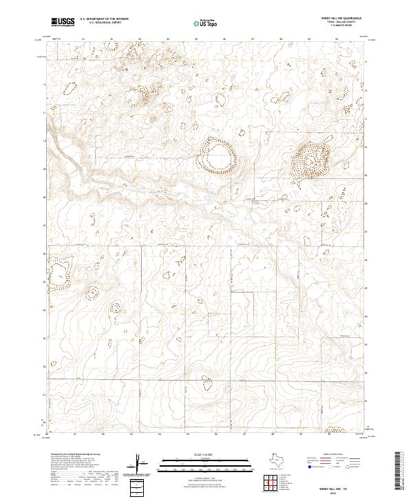
2022 Map of Windy Hill NW
USGS Topo · Published 2022About this map
The High Plains of the Texas Panhandle define this landscape, where the ephemeral flow of Carrizo Cr carves a winding path through the northern Dallam County ranchland. This 2022 survey documents a rural environment organized by a geometric grid of family-named roads and ranch routes. Significant thoroughfares like Ranch Rd 102 and Mcadams Rd provide the primary framework for movement across the open territory. These routes, alongside smaller tracks like Lamberger Rd and Yoder Rd, reflect a history of coordinated land use and settlement in one of the most northern reaches of Texas. The absence of traditional town centers highlights the ranching economy, where distance between landmarks like Herring Rd and Nichols Rd is measured by the vast stretches of open prairie that remain characteristic of the region.
Find a feature on this map
12 named features on this map. Tap any name to fly to it.
Don’t see what you’re looking for? This feature index may not catch every label — zoom into the map to look around manually.
Map Details
Editions of this 2022 Windy Hill NW Map
This is the sole edition of this map. No revisions or reprints were ever made.
Other maps of this area

1954 · Dalhart
USGS Topo · 1:250,000

1958 · Dalhart
USGS Topo · 1:250,000

1962 · Dalhart
USGS Topo · 1:250,000

1970 · Texline South
USGS Topo · 1:24,000

1970 · Sedan SE
USGS Topo · 1:24,000

1970 · Sedan NE
USGS Topo · 1:24,000

1973 · Wharton Ranch
USGS Topo · 1:24,000

1973 · Corlena
USGS Topo · 1:24,000

1973 · Perico
USGS Topo · 1:24,000
1973 · Windy Hill
USGS Topo · 1:24,000