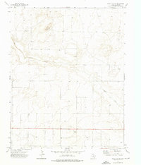
1973 Map of Windy Hill NW
USGS Topo · Published 1976About this map
Carrizo Creek meanders through this high plains landscape of Dallam County, providing a rare watercourse in an area largely defined by intermittent drainage and agricultural infrastructure. The territory, surveyed in the early 1970s, is characterized by a sparse network of ranching landmarks and a significant number of groundwater extraction points. Named features like the Higgins Sandhill Windmill and the settlement of Knight offer specific points of interest for local historians tracking the development of these northwestern Texas ranchlands. The map reveals the persistence of early 20th-century land use patterns, where fence lines and isolated wells are the primary indicators of human presence across the undulating terrain. This USGS record preserves the rural character of the Panhandle before contemporary shifts in land management altered the traditional ranching grid.
Find a feature on this map
5 named features on this map. Tap any name to fly to it.
Don’t see what you’re looking for? This feature index may not catch every label — zoom into the map to look around manually.
Map Details
Editions of this 1973 Windy Hill NW Map
This is the sole edition of this map. No revisions or reprints were ever made.
Other maps of this area

1954 · Dalhart
USGS Topo · 1:250,000

1958 · Dalhart
USGS Topo · 1:250,000

1962 · Dalhart
USGS Topo · 1:250,000

1970 · Texline South
USGS Topo · 1:24,000

1970 · Sedan SE
USGS Topo · 1:24,000

1970 · Sedan NE
USGS Topo · 1:24,000

1973 · Wharton Ranch
USGS Topo · 1:24,000

1973 · Corlena
USGS Topo · 1:24,000

1973 · Perico
USGS Topo · 1:24,000
1973 · Windy Hill
USGS Topo · 1:24,000