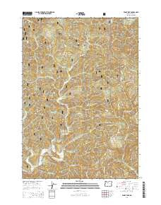
2014 Map of Windy Peak
USGS Topo · Published 2014About this map
The Deadwood Creek Covered Bridge serves as a distinct landmark in this heavily forested region of Lane County, where the settlement of Alpha sits along the banks of Deadwood Cr. This portion of the Siuslaw National Forest is defined by its complex drainage systems and prominent landforms like Wilson Ridge and Buck Creek Ridge. The map details a network of forest development roads, including Brooks Rd and Bassonette Rd, which navigate the steep elevations leading to Windy Peak. Numerous watercourses, such as Karlstrom Cr, Alpha Cr, and Steinbauer Cr, underscore the area's geography as a watershed for the larger Lobster Cr system. The map documents the mid-2010s state of these public lands, highlighting the intersection of natural topography and local transportation infrastructure used for forest management and access.
Find a feature on this map
39 named features on this map. Tap any name to fly to it.
Don’t see what you’re looking for? This feature index may not catch every label — zoom into the map to look around manually.
Map Details
Editions of this 2014 Windy Peak Map
This is the sole edition of this map. No revisions or reprints were ever made.
Other maps of this area

1918 · Mapleton
USGS Topo · 1:48,000

1940 · Mapleton
USGS Topo · 1:62,500

1941 · Blachly
USGS Topo · 1:62,500

1942 · Alsea
USGS Topo · 1:62,500

1942 · Blachly
USGS Topo · 1:62,500

1942 · Tidewater
USGS Topo · 1:62,500

1945 · Mapleton
USGS Topo · 1:62,500

1953 · Salem
USGS Topo · 1:250,000

1954 · Salem
USGS Topo · 1:250,000

1956 · Alsea
USGS Topo · 1:62,500