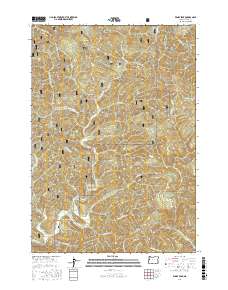
2017 Map of Windy Peak
USGS Topo · Published 2017About this map
Alpha sits at a crossroads of timber and water within the Siuslaw National Forest, serving as a central point for a landscape defined by its deep drainage basins and prominent summits. The terrain is structured by massive landforms like Wilson Ridge and Buck Creek Ridge, while the eponymous Windy Peak rises as a landmark in the southeastern section. This 2017 survey details a complex network of forestry infrastructure, including Natl Forest Develop Road 35 Rd and numerous Bureau of Land Management routes that navigate the steep slopes between Deadwood Creek and Greenleaf Creek.
Find a feature on this map
59 named features on this map. Tap any name to fly to it.
Don’t see what you’re looking for? This feature index may not catch every label — zoom into the map to look around manually.
Map Details
Editions of this 2017 Windy Peak Map
This is the sole edition of this map. No revisions or reprints were ever made.
Other maps of this area

1918 · Mapleton
USGS Topo · 1:48,000

1940 · Mapleton
USGS Topo · 1:62,500

1941 · Blachly
USGS Topo · 1:62,500

1942 · Alsea
USGS Topo · 1:62,500

1942 · Blachly
USGS Topo · 1:62,500

1942 · Tidewater
USGS Topo · 1:62,500

1945 · Mapleton
USGS Topo · 1:62,500

1953 · Salem
USGS Topo · 1:250,000

1954 · Salem
USGS Topo · 1:250,000

1956 · Alsea
USGS Topo · 1:62,500