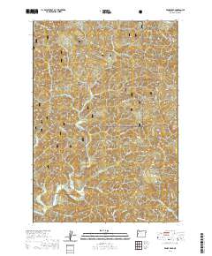
2020 Map of Windy Peak
USGS Topo · Published 2020About this map
Alpha sits at the heart of this drainage basin within the Siuslaw National Forest, where the landscape is defined by the winding course of Deadwood Cr and its many tributaries. The area is characterized by a dense network of ridges, including Wilson Ridge and Buck Creek Ridge, which separate the various creek valleys. A notable landmark for local history and architecture is the Deadwood Creek Covered Bridge, located in the southwest, crossing the water near where Karlstrom Cr and W Fork Deadwood Cr join the main flow. To the southeast, the terrain rises toward the summit of Windy Peak. The map reveals a complex system of Forest Service and Bureau of Land Management roads, such as Greenleaf Creek Rd and 17-8-31 Rd, which provide access through the timberlands and follow the natural contours of the steep valleys like Alpha Cr and Bear Cr.
Find a feature on this map
48 named features on this map. Tap any name to fly to it.
Don’t see what you’re looking for? This feature index may not catch every label — zoom into the map to look around manually.
Map Details
Editions of this 2020 Windy Peak Map
This is the sole edition of this map. No revisions or reprints were ever made.
Other maps of this area

1918 · Mapleton
USGS Topo · 1:48,000

1940 · Mapleton
USGS Topo · 1:62,500

1941 · Blachly
USGS Topo · 1:62,500

1942 · Alsea
USGS Topo · 1:62,500

1942 · Blachly
USGS Topo · 1:62,500

1942 · Tidewater
USGS Topo · 1:62,500

1945 · Mapleton
USGS Topo · 1:62,500

1953 · Salem
USGS Topo · 1:250,000

1954 · Salem
USGS Topo · 1:250,000

1956 · Alsea
USGS Topo · 1:62,500