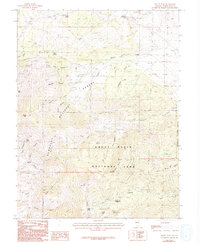
1987 Map of Windy Peak
USGS Topo · Published 1993About this map
Great Basin National Park and the Humboldt National Forest dominate this high-altitude survey of White Pine County, Nevada. The landscape is defined by steep drainage basins and alpine water sources such as Stella Lake, Teresa Lake, and Brown Lake, which sit at the base of the Blue Ridge and Bald Mountain. The topographic detail reveals a legacy of resource extraction throughout the Snake Range, with numerous prospects, a Mine Shaft, and various unnamed mines dotting the slopes of Lucky Boy Canyon and Mc Graff Canyon.
Find a feature on this map
41 named features on this map. Tap any name to fly to it.
Don’t see what you’re looking for? This feature index may not catch every label — zoom into the map to look around manually.
Map Details
Editions of this 1987 Windy Peak Map
2 editions found
Other maps of this area

1948 · Wheeler Peak
USGS Topo · 1:62,500

1949 · Garrison
USGS Topo · 1:62,500

1950 · Wheeler Peak
USGS Topo · 1:62,500

1951 · Garrison
USGS Topo · 1:62,500

1956 · Lund
USGS Topo · 1:250,000

1956 · Ely
USGS Topo · 1:250,000

1959 · Ely
USGS Topo · 1:250,000

1959 · Sacramento Pass
USGS Topo · 1:62,500

1960 · Lund
USGS Topo · 1:250,000

1963 · Ely
USGS Topo · 1:250,000