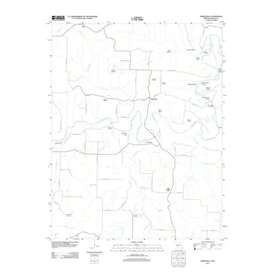
2011 Map of Windyville
USGS Topo · Published 2011About this map
The Niangua River meanders through this portion of Dallas County, carving out high overlooks such as Hildebrand Bluff, Mary Sharp Bluff, and Bramwell Bluff. The settlement of Windyville sits at a central junction, surrounded by smaller locales like Tilden and Plad. This landscape is defined by its deep hollows, including Schoolhouse Hollow and Granny Hollow, and its numerous small family and community burial grounds like Scrivner Cemetery, Hildebrand Cemetery, and Peppers Cemetery.
Find a feature on this map
60 named features on this map. Tap any name to fly to it.
Don’t see what you’re looking for? This feature index may not catch every label — zoom into the map to look around manually.
Map Details
Editions of this 2011 Windyville Map
This is the sole edition of this map. No revisions or reprints were ever made.
Other maps of this area

1884 · Bolivar
USGS Topo · 1:125,000

1892 · Bolivar
USGS Topo · 1:125,000

1934 · Macks Creek
USGS Topo · 1:48,000

1939 · Macks Creek
USGS Topo · 1:62,500

1939 · Long Lane
USGS Topo · 1:62,500

1942 · Long Lane
USGS Topo · 1:62,500

1954 · Springfield
USGS Topo · 1:250,000

1958 · Springfield
USGS Topo · 1:250,000

1959 · Springfield
USGS Topo · 1:250,000
1960 · Tunas
USGS Topo · 1:24,000