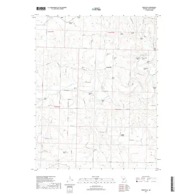
2017 Map of Windyville
USGS Topo · Published 2017About this map
Windyville and Plad serve as the primary nodes of settlement in this northern Ozark region, where the Niangua River carves a winding path through a landscape of bluffs and hollows. The river's influence is evident in the numerous named overlooks like Bramwell Bluff, Cowan Bluff, and Smith Bluff. Local genealogy is well-documented through a network of small, rural cemeteries, including Scrivner Cem, Hildebrand Cem, and Peppers Cem, many of which are tucked away near Indian Cr or Fourmile Cr. The terrain is characterized by intricate drainage systems, with landmarks like Smelter Hollow, Granny Hollow, and Sugartree Hollow reflecting the traditional naming conventions of the area. This survey provides a modern snapshot of the Dallas County countryside, showing how contemporary routes like State Rd K and State Hwy MM overlay the historic settlement patterns of Cedar Ridge and surrounding homesteads.
Find a feature on this map
91 named features on this map. Tap any name to fly to it.
Don’t see what you’re looking for? This feature index may not catch every label — zoom into the map to look around manually.
Map Details
Editions of this 2017 Windyville Map
This is the sole edition of this map. No revisions or reprints were ever made.
Other maps of this area

1884 · Bolivar
USGS Topo · 1:125,000

1892 · Bolivar
USGS Topo · 1:125,000

1934 · Macks Creek
USGS Topo · 1:48,000

1939 · Macks Creek
USGS Topo · 1:62,500

1939 · Long Lane
USGS Topo · 1:62,500

1942 · Long Lane
USGS Topo · 1:62,500

1954 · Springfield
USGS Topo · 1:250,000

1958 · Springfield
USGS Topo · 1:250,000

1959 · Springfield
USGS Topo · 1:250,000
1960 · Tunas
USGS Topo · 1:24,000