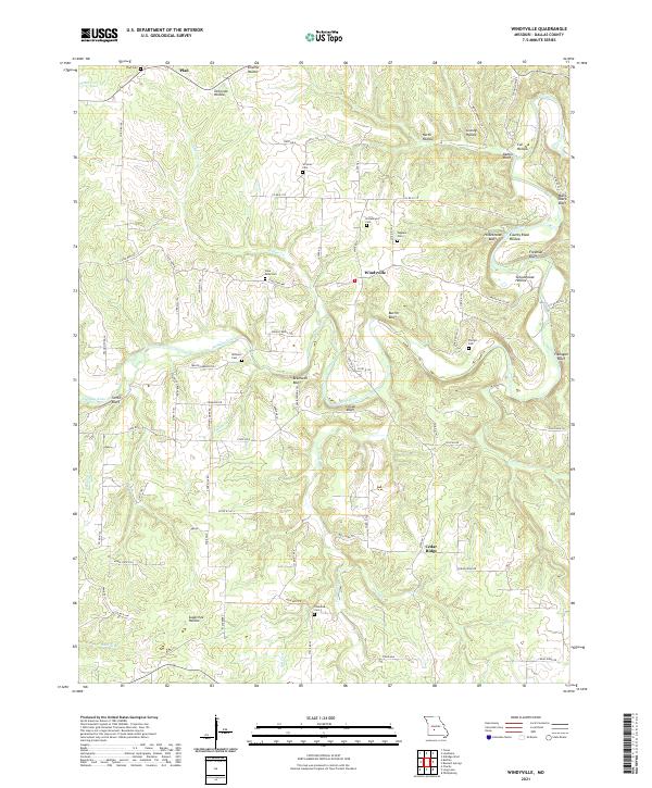
2021 Map of Windyville
USGS Topo · Published 2021About this map
The Niangua River winds through the heart of this Dallas County landscape, carving a series of prominent bluffs and hollows that define the local geography. Significant topographic features like Bramwell Bluff, Kahler Bluff, and Mary Sharp Bluff line the river's path, while deep drainages such as Schoolhouse Hollow and Granny Hollow reach back into the uplands. This area is characterized by scattered rural settlements including Windyville, Plad, and Cedar Ridge, each connected by a network of state and county roads.
Find a feature on this map
79 named features on this map. Tap any name to fly to it.
Don’t see what you’re looking for? This feature index may not catch every label — zoom into the map to look around manually.
Map Details
Editions of this 2021 Windyville Map
This is the sole edition of this map. No revisions or reprints were ever made.
Other maps of this area

1884 · Bolivar
USGS Topo · 1:125,000

1892 · Bolivar
USGS Topo · 1:125,000

1934 · Macks Creek
USGS Topo · 1:48,000

1939 · Macks Creek
USGS Topo · 1:62,500

1939 · Long Lane
USGS Topo · 1:62,500

1942 · Long Lane
USGS Topo · 1:62,500

1954 · Springfield
USGS Topo · 1:250,000

1958 · Springfield
USGS Topo · 1:250,000

1959 · Springfield
USGS Topo · 1:250,000
1960 · Tunas
USGS Topo · 1:24,000