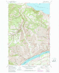
1968 Map of Winesap
USGS Topo · Published 1987About this map
The rugged terrain between the Columbia River and the southern tip of Lake Chelan dominates this 1968 survey, showcasing a landscape shaped by glacial coulees and modern infrastructure. The small settlement of Winesap is situated near the riverbanks, served by the Burlington Northern railroad and Stayman Road. High above the water, Navarre Coulee and Knapp Coulee provide natural corridors through the peaks of the Wenatchee National Forest. Extensive conservation lands, including the Entiat State Wildlife Area and Chelan Butte State Wildlife Area, preserve the character of the slopes. Along the lake shore, recreational development is evident at Wapato Point and Sunnybank, while Lake Chelan State Park marks the transition from the steep canyon walls to the water's edge.
Find a feature on this map
31 named features on this map. Tap any name to fly to it.
Don’t see what you’re looking for? This feature index may not catch every label — zoom into the map to look around manually.
Map Details
Editions of this 1968 Winesap Map
Other maps of this area

1901 · Chelan
USGS Topo · 1:125,000

1957 · Wenatchee
USGS Topo · 1:250,000

1968 · Chelan
USGS Topo · 1:24,000

1968 · Waterville
USGS Topo · 1:24,000
1968 · Cooper Ridge
USGS Topo · 1:24,000

1968 · Entiat
USGS Topo · 1:24,000
1968 · Stormy Mtn.
USGS Topo · 1:24,000

1968 · Ardenvoir
USGS Topo · 1:24,000

1968 · Baldy Mtn
USGS Topo · 1:24,000

1968 · Winesap
USGS Topo · 1:24,000