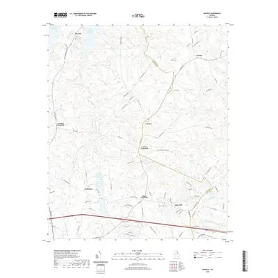
2020 Map of Winfield
USGS Topo · Published 2020About this map
J. Strom Thurmond Reservoir defines the northern reaches of this landscape, where the waters of Raysville meet the rolling transition into Georgia’s interior. The terrain is a network of ridge-top roads and creek valleys, characterized by historical crossroads like Cobbham and Stones Crossroads. For those tracing local heritage, the map reveals key landmarks such as Collins Cem and Ansley Mill, tucked along the numerous drainage systems like Germany Cr and Shiloh Fork. The settlement pattern reflects a deeply rooted rural economy, connected by historic paths such as Stagecoach Rd and Cobbham Rd. From the elevation at Mt Carmel to the scattered clusters at Scuffletown, the map preserves the layout of a region defined by its topography and the enduring intersections of small-town life.
Find a feature on this map
78 named features on this map. Tap any name to fly to it.
Don’t see what you’re looking for? This feature index may not catch every label — zoom into the map to look around manually.
Map Details
Editions of this 2020 Winfield Map
This is the sole edition of this map. No revisions or reprints were ever made.
Other maps of this area

1892 · Mc Cormick
USGS Topo · 1:125,000

1906 · Crawfordville
USGS Topo · 1:125,000

1912 · Mc Cormick
USGS Topo · 1:125,000

1921 · Appling
USGS Topo · 1:62,500

1922 · Harlem
USGS Topo · 1:62,500

1943 · Appling
USGS Topo · 1:62,500

1948 · Harlem
USGS Topo · 1:62,500

1948 · Harlem
USGS Topo · 1:24,000

1948 · Thomson East
USGS Topo · 1:24,000

1950 · Dearing
USGS Topo · 1:24,000