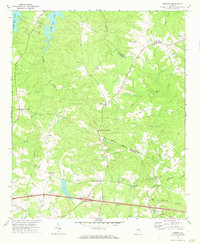
1972 Map of Winfield
USGS Topo · Published 1973About this map
Clark Hill Lake defines the northwestern corner of this landscape, its controlled waters reaching into the inlets of Germany Creek and Rousseau Creek. This 1972 survey captures the rural character of the Columbia and McDuffie County border, a region punctuated by long-established crossroads and small agrarian hubs. The settlement of Winfield sits near the northeastern edge, served by Sharon Ch and Mt Carmel Ch, while the southern corridor is anchored by Jones Chapel and the White Oak Campground. The mapping reveals a network of country churches and family-named points like Ansley Mill and Stones Crossroads. These features, alongside the White Oak Grove Cem and Scuffletown, reflect a persistent pattern of rural Georgia life centered around localized community nodes and the creek systems of Greenbrier Creek and White Oak Branch.
Find a feature on this map
33 named features on this map. Tap any name to fly to it.
Don’t see what you’re looking for? This feature index may not catch every label — zoom into the map to look around manually.
Map Details
Editions of this 1972 Winfield Map
This is the sole edition of this map. No revisions or reprints were ever made.
Other maps of this area

1892 · Mc Cormick
USGS Topo · 1:125,000

1906 · Crawfordville
USGS Topo · 1:125,000

1912 · Mc Cormick
USGS Topo · 1:125,000

1921 · Appling
USGS Topo · 1:62,500

1922 · Harlem
USGS Topo · 1:62,500

1943 · Appling
USGS Topo · 1:62,500

1948 · Harlem
USGS Topo · 1:62,500

1948 · Harlem
USGS Topo · 1:24,000

1948 · Thomson East
USGS Topo · 1:24,000

1950 · Dearing
USGS Topo · 1:24,000