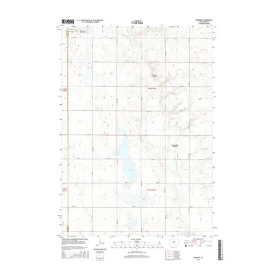
2015 Map of Winfred
USGS Topo · Published 2015About this map
Winfred sits at the northwestern edge of this Lake County landscape, where the town plat is defined by Central Ave and Prospect Ave. This 2015 survey illustrates a rural South Dakota topography dominated by the Coteau des Prairies, a vast glacial upland that shapes the local drainage. Water is central to the area's layout, with the E Fork Vermillion River winding southward through a series of significant basins including Lake Henry and Lake George. Southeast of the primary settlement, the Graceville Colony represents a distinct communal land-use pattern within the township. The map provides a precise record of the section-line road network, such as 240th St and 444th Ave, which partition the agricultural landscape between the Miner and Lake county line.
Find a feature on this map
28 named features on this map. Tap any name to fly to it.
Don’t see what you’re looking for? This feature index may not catch every label — zoom into the map to look around manually.
Map Details
Editions of this 2015 Winfred Map
This is the sole edition of this map. No revisions or reprints were ever made.
Other maps of this area

1953 · Watertown
USGS Topo · 1:250,000

1955 · Sioux Falls
USGS Topo · 1:250,000

1958 · Sioux Falls
USGS Topo · 1:250,000

1958 · Watertown
USGS Topo · 1:250,000

1968 · Oldham SW
USGS Topo · 1:24,000

1968 · Ramona
USGS Topo · 1:24,000

1968 · Lake Madison SW
USGS Topo · 1:24,000

1968 · Lake Herman
USGS Topo · 1:24,000

1968 · Oldham SE
USGS Topo · 1:24,000
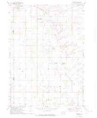
1971 · Winfred
USGS Topo · 1:24,000
Featured Places
- Winfred, SD
- Clarno Township, SD
- Vermillion Township, SD
- Gracevale Hutterite Colony, SD
- Winfred Township, SD