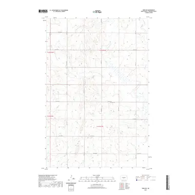
2020 Map of Wing SW
USGS Topo · Published 2020About this map
The rolling prairies of Burleigh County define this landscape, where the seasonal drainage of E Br Apple Cr carves through the undulating terrain. This 2020 edition provides a clear record of the section line road network that has structured North Dakota's agricultural heartland for over a century. Landmarks of the local community are centered around features like Union Cem, located near the junction of 227th Ave NE and 223rd St NE. The map illustrates the persistent grid of the Public Land Survey System, including townships t142n r77w and t141n r77w. This document is a vital resource for understanding the contemporary layout of the rural landscape, showing how modern corridors like 184th St NE and 279th Ave NE continue to follow historical land divisions.
Find a feature on this map
18 named features on this map. Tap any name to fly to it.
Don’t see what you’re looking for? This feature index may not catch every label — zoom into the map to look around manually.
Map Details
Editions of this 2020 Wing SW Map
This is the sole edition of this map. No revisions or reprints were ever made.
Other maps of this area

1907 · Bismarck
USGS Topo · 1:125,000

1951 · Menoken
USGS Topo · 1:62,500

1951 · McKenzie
USGS Topo · 1:62,500

1954 · Bismarck
USGS Topo · 1:250,000

1954 · McClusky
USGS Topo · 1:250,000

1958 · Bismarck
USGS Topo · 1:250,000

1958 · McClusky
USGS Topo · 1:250,000

1975 · Sibley Butte
USGS Topo · 1:24,000
1975 · Solberg Butte
USGS Topo · 1:24,000

1975 · Wing SE
USGS Topo · 1:24,000