
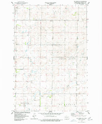
1975 Map of Sibley Butte
USGS Topo · Published 1977About this map
Sibley Butte dominates the local topography of this Burleigh County landscape, providing a primary landmark in a region defined by township divisions and small-scale resource extraction. The area is organized into distinct townships including Trygg, Christiania, Mc Kenzie, and Sterling, reflecting the systematic settlement patterns of the North Dakota plains. The hydrography of the quadrangle is marked by Rice Lake in the northeast and the wandering path of the East Branch Apple Creek, which cuts through the central sections.
Find a feature on this map
12 named features on this map. Tap any name to fly to it.
Don’t see what you’re looking for? This feature index may not catch every label — zoom into the map to look around manually.
Map Details
Editions of this 1975 Sibley Butte Map
This is the sole edition of this map. No revisions or reprints were ever made.
Other maps of this area

1951 · McKenzie
USGS Topo · 1:62,500

1951 · Driscoll
USGS Topo · 1:62,500

1954 · Bismarck
USGS Topo · 1:250,000

1954 · McClusky
USGS Topo · 1:250,000

1958 · Bismarck
USGS Topo · 1:250,000

1958 · McClusky
USGS Topo · 1:250,000

1975 · McKenzie
USGS Topo · 1:24,000

1975 · Sterling
USGS Topo · 1:24,000

1975 · Wing SE
USGS Topo · 1:24,000
1975 · McKenzie NW
USGS Topo · 1:24,000