
1975 Map of Sterling
USGS Topo · Published 1977About this map
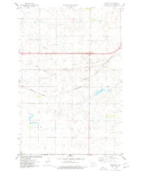
Sterling sits at a critical junction in Burleigh County, where the historic east-west corridor meets a primary north-south route. This 1975 orthophotoquad reveals the stark geometry of the North Dakota prairie, showing a landscape dominated by the Rectangular Survey System and large-scale agricultural operations. The community of Sterling is seen in detail, revealing the clusters of structures and grain elevators that supported the local farming economy. To the south, the meandering course of Random Creek provides a natural contrast to the rigid section lines of the surrounding fields. The imagery captures the area just as Interstate 94 was solidifying its role as the region's main artery, bypassing the older tracks of Route 10. This view is particularly valuable for researchers tracing the physical evolution of small prairie settlements and the layout of rural farmsteads in the late twentieth century.
Find a feature on this map
5 named features on this map. Tap any name to fly to it.
Don’t see what you’re looking for? This feature index may not catch every label — zoom into the map to look around manually.
Map Details
Editions of this 1975 Sterling Map
2 editions found
Other maps of this area

1951 · McKenzie
USGS Topo · 1:62,500

1951 · Driscoll
USGS Topo · 1:62,500

1954 · Bismarck
USGS Topo · 1:250,000

1958 · Bismarck
USGS Topo · 1:250,000

1971 · Moffit NW
USGS Topo · 1:24,000

1971 · Moffit
USGS Topo · 1:24,000

1975 · McKenzie
USGS Topo · 1:24,000

1975 · Sibley Butte
USGS Topo · 1:24,000
1975 · McKenzie NW
USGS Topo · 1:24,000
1975 · Clear Lake
USGS Topo · 1:24,000