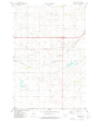
1975 Map of Sterling
USGS Topo · Published 1977About this map
Sterling serves as the focal point of this mid-1970s survey, situated at a critical crossroads of rail and road infrastructure in Burleigh County. The Burlington Northern railroad bisects the landscape, running parallel to an Old Grade and various transit corridors that speak to the area's logistical importance. Local history and genealogy are anchored at the Sterling Cem, located just north of the town center near several Gravel Pit operations. The natural drainage of the region is defined by the winding course of Random Creek and the man-made Sterling Reservoir to the southeast. Industrial activity is further evidenced by a prominent Pipeline cutting across the northern sections and a rural Landing Strip, illustrating a landscape shaped by transportation and resource extraction in the Great Plains.
Find a feature on this map
18 named features on this map. Tap any name to fly to it.
Don’t see what you’re looking for? This feature index may not catch every label — zoom into the map to look around manually.
Map Details
Editions of this 1975 Sterling Map
2 editions found
Other maps of this area

1951 · McKenzie
USGS Topo · 1:62,500

1951 · Driscoll
USGS Topo · 1:62,500

1954 · Bismarck
USGS Topo · 1:250,000

1958 · Bismarck
USGS Topo · 1:250,000

1971 · Moffit NW
USGS Topo · 1:24,000

1971 · Moffit
USGS Topo · 1:24,000

1975 · McKenzie
USGS Topo · 1:24,000

1975 · Sibley Butte
USGS Topo · 1:24,000

1975 · Sterling
USGS Topo · 1:24,000
1975 · McKenzie NW
USGS Topo · 1:24,000