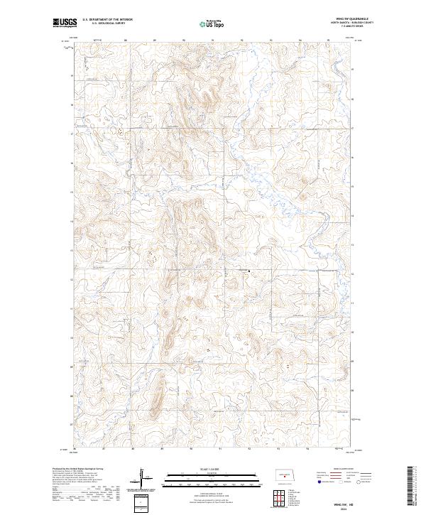
2024 Map of Wing SW
USGS Topo · Published 2024About this map
Union Cem stands as a central historical landmark within this section of Burleigh County, situated near the intersection of 227th Ave NE and 223rd St NE. The landscape is defined by the drainage of the East Branch Apple Creek, which meanders through the northeastern corner of the map. This 2024 survey reflects the persistent rural grid system of the North Dakota prairie, where a network of numbered section roads like 197th St NE and 201st Ave NE facilitate movement across the undulating terrain. The layout of these roads and the placement of the local cemetery illustrate the long-standing land use patterns that have defined this agricultural region for generations, providing a clear reference for those tracing property boundaries or family history in the area.
Find a feature on this map
18 named features on this map. Tap any name to fly to it.
Don’t see what you’re looking for? This feature index may not catch every label — zoom into the map to look around manually.
Map Details
Editions of this 2024 Wing SW Map
This is the sole edition of this map. No revisions or reprints were ever made.
Other maps of this area

1907 · Bismarck
USGS Topo · 1:125,000

1951 · Menoken
USGS Topo · 1:62,500

1951 · McKenzie
USGS Topo · 1:62,500

1954 · Bismarck
USGS Topo · 1:250,000

1954 · McClusky
USGS Topo · 1:250,000

1958 · Bismarck
USGS Topo · 1:250,000

1958 · McClusky
USGS Topo · 1:250,000

1975 · Sibley Butte
USGS Topo · 1:24,000
1975 · Solberg Butte
USGS Topo · 1:24,000

1975 · Wing SE
USGS Topo · 1:24,000