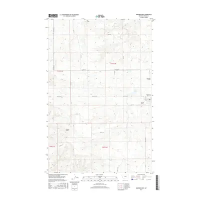
2017 Map of Winifred West
USGS Topo · Published 2017About this map
The settlement of Winifred serves as the focal point of this Fergus County survey, situated at the edge of a landscape defined by dramatic coulees and creek beds. To the west, the Winifred Airport and the waters of Stafford Reservoir are prominent landmarks within the township of T21N R18E. The terrain is marked by significant drainages including Flax Coulee and Sig Larson Coulee, which cut through the high plains toward the north.
Find a feature on this map
25 named features on this map. Tap any name to fly to it.
Don’t see what you’re looking for? This feature index may not catch every label — zoom into the map to look around manually.
Map Details
Editions of this 2017 Winifred West Map
This is the sole edition of this map. No revisions or reprints were ever made.
Other maps of this area

1954 · Taffy Ridge
USGS Topo · 1:24,000

1954 · Gallatin Rapids
USGS Topo · 1:24,000

1954 · Council Island
USGS Topo · 1:24,000

1954 · Lewistown
USGS Topo · 1:250,000

1959 · Lewistown
USGS Topo · 1:250,000

1964 · Anderson Bridge
USGS Topo · 1:24,000

1978 · Wild Bill Flat East
USGS Topo · 1:24,000

1978 · Lewistown
USGS Topo · 1:100,000
1985 · Hilger NW
USGS Topo · 1:24,000
1985 · Christina
USGS Topo · 1:24,000