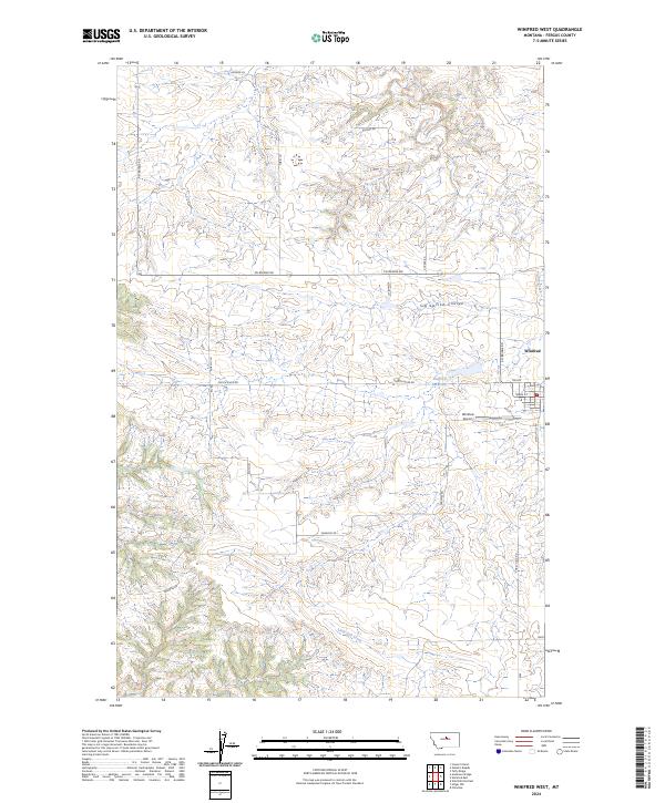
2024 Map of Winifred West
USGS Topo · Published 2024About this map
Winifred serves as the primary hub of this Fergus County landscape, where the grain-handling and transportation network meets the open plains. The map details the local infrastructure supporting this agricultural community, from the Winifred Airport to the Trk Byp and Main St. Beyond the town site, the terrain is defined by the drainage patterns of Dog Creek and Sig Larson Coulee, which cut through the high plains toward the Judith River valley. Family-named routes like Heggem Ln, Kucera Rd, and Tobin Ln trace the original homestead patterns of the region. The map also captures critical water management features like Stafford Reservoir, essential for ranching and farming in this semi-arid part of Montana.
Find a feature on this map
22 named features on this map. Tap any name to fly to it.
Don’t see what you’re looking for? This feature index may not catch every label — zoom into the map to look around manually.
Map Details
Editions of this 2024 Winifred West Map
This is the sole edition of this map. No revisions or reprints were ever made.
Other maps of this area

1954 · Taffy Ridge
USGS Topo · 1:24,000

1954 · Gallatin Rapids
USGS Topo · 1:24,000

1954 · Council Island
USGS Topo · 1:24,000

1954 · Lewistown
USGS Topo · 1:250,000

1959 · Lewistown
USGS Topo · 1:250,000

1964 · Anderson Bridge
USGS Topo · 1:24,000

1978 · Wild Bill Flat East
USGS Topo · 1:24,000

1978 · Lewistown
USGS Topo · 1:100,000
1985 · Hilger NW
USGS Topo · 1:24,000
1985 · Christina
USGS Topo · 1:24,000