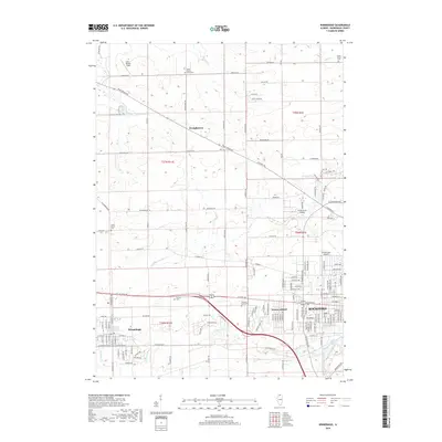
2018 Map of Winnebago
USGS Topo · Published 2018About this map
The western suburbs of Rockford and the neighboring village of Winnebago define this landscape, where residential expansion meets the agricultural plains of northern Illinois. The terrain is structured by the dendritic drainage of N Fork Kent Cr and S Fork Kent Cr, which converge near Westmoreland before flowing toward the Rock River. Local history and genealogy are anchored by several established cemeteries, including Calvary Cem, Willwood Burial Park, and the outlying North Burritt Union Cem near Wempletown.
Find a feature on this map
72 named features on this map. Tap any name to fly to it.
Don’t see what you’re looking for? This feature index may not catch every label — zoom into the map to look around manually.
Map Details
Editions of this 2018 Winnebago Map
This is the sole edition of this map. No revisions or reprints were ever made.
Other maps of this area

1917 · Kings
USGS Topo · 1:62,500

1918 · Rockford
USGS Topo · 1:62,500

1918 · Kings
USGS Topo · 1:62,500

1922 · Oregon
USGS Topo · 1:62,500

1924 · Oregon
USGS Topo · 1:62,500

1932 · Pecatonica
USGS Topo · 1:62,500

1936 · Pecatonica
USGS Topo · 1:62,500

1938 · Rockford
USGS Topo · 1:62,500

1949 · Camp Grant
USGS Topo · 1:24,000

1949 · Rockford
USGS Topo · 1:24,000