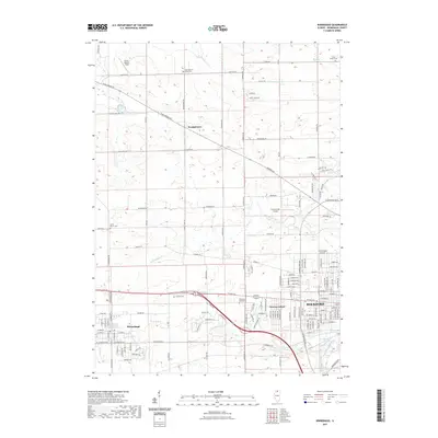
2021 Map of Winnebago
USGS Topo · Published 2021About this map
The village of Winnebago and the western edge of Rockford anchor this 2021 survey of northern Illinois. The landscape transitions from the urban density of Westmoreland to a grid of agricultural land and suburban expansion marked by historical burial grounds like North Burritt Union Cem and Calvary Cem. Small aviation hubs, including Early Merkel Field and LZ Fairwinds Airport, are scattered across the terrain, reflecting the modern utility of the open fields outside the city core.
Find a feature on this map
138 named features on this map. Tap any name to fly to it.
Don’t see what you’re looking for? This feature index may not catch every label — zoom into the map to look around manually.
Map Details
Editions of this 2021 Winnebago Map
This is the sole edition of this map. No revisions or reprints were ever made.
Other maps of this area

1917 · Kings
USGS Topo · 1:62,500

1918 · Rockford
USGS Topo · 1:62,500

1918 · Kings
USGS Topo · 1:62,500

1922 · Oregon
USGS Topo · 1:62,500

1924 · Oregon
USGS Topo · 1:62,500

1932 · Pecatonica
USGS Topo · 1:62,500

1936 · Pecatonica
USGS Topo · 1:62,500

1938 · Rockford
USGS Topo · 1:62,500

1949 · Camp Grant
USGS Topo · 1:24,000

1949 · Rockford
USGS Topo · 1:24,000